Pages

Sunday, October 31, 2010

We saw an alligator!

What, you expected a picture of it? Well, sorry, it slipped into the water before I could get my camera. But we really did see a 5-6 foot alligator on the bank of the Tombigbee River here in Alabama, about 80 miles north of where we are now on the Gulf Coast. Rick was doing "bow duty" (sightseeing from the bow) and he spotted it slowly plodding toward the water. I got out the binoculars and watched as he took his final several steps into the water. So cool! No more swimming for us!

This picture is from Columbus, MS, the last time we stayed in a marina before tonight. We are now in Mobile, back in salt water, but luckily we've seen no signs of the oil spill.

When I last posted, we were in the marina in Columbus on our first of two days there. It was a good thing we stayed the second day because that was the day the terrible winds and rain swept across the Midwest and did so much damage. We were at the southern end of that front and also had periods of intense winds and rain. When it cleared in the afternoon, we used the courtesy car and went sightseeing.

Columbus has about 200 antebellum homes because it was never touched during the Civil War. This was just one of the many spectacular estates we saw.

In front of the Columbus Court House was a Civil War statue. On the top was this soldier holding his rifle. A local man clued us in as to what the statue becomes when you view it from the side..... (see next photo)

....a Klansman. Oh my gosh. I suppose their official explanation is that it's just a coincidence. I doubt it.

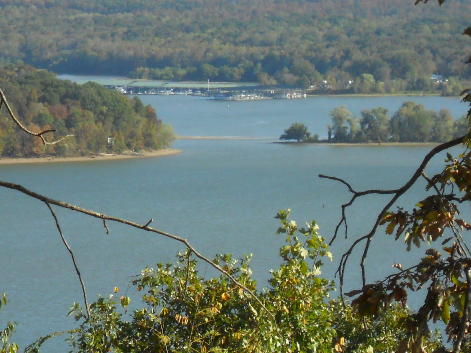
The scenery along the entire Tombigbee River has been naturally beautiful - just tall trees or cliffs or sandy beaches, with hardly any industry and only an occasional dwelling. It is a very curvy and winding river too, so it gives you the sense that you're on a wild waterway compared to the major rivers we'd been on before. The houses are "country", certainly not the estates that have been more typical along the entire Great Loops waterways up til now.

Here's a home, but what made it interesting was the phone booth sitting there. They must have a teenager who lacks a cellphone but still wants his phone privacy!

This is the US Snagboat Montgomery, at the Tom Bevill Visitor Center in Alabama. We anchored and took the dinghy to the dock next to the Center for a visit. This old paddlewheeler is on display, having been built in 1926 and in service until 1982. It has a crane on the front that lifted trees and other debris from the rivers to keep them clear for river traffic. The center was full of interesting displays on the Tenn-Tom Waterway and the days of steam paddlewheelers.

One two-mile section of the river had these dramatic chalk cliffs.

Here's another section of cliffs, and this picture is neat because of the reflection in the glassy morning water. Several spots along the river had stunning cliffs like this. So beautiful! We had the river virtually to ourselves for the past five days. A few barges would pass us each day, but we would almost never see another boat, other than small fishing boats, until we reached our anchorage.

The anchorages are few and far between along the Tenn-Tom, with only a few marinas. The last marina was at Demopolis, but it has been full because when the oil spill happened, boats from the Gulf were taken up there and have stayed.

The safe anchorages were only about every 35 miles, so those of us on the move these past four days have tended to aim for the same ones each night (although there was some leap-frogging too because boats cruise at different speeds). They were LONG days of non-stop cruising; four 9-hour days and one 10-hr day. As we would finally arrive at our intended anchorages, we had to sweat out whether we'd get a spot because they are small and hold only a few boats. Luckily we always did, but there's no room to swing on your anchor, so we had to set a second anchor out behind the boat.

This picture shows one narrow anchorage, where we had this boat in front of us (who anchored with us four times) and another behind us. It ALSO shows the fog we had that morning. What a harrowing experience THAT turned out to be. The fog looked like it was lifting, and this boat in the picture left, so we did too. As I entered the main river, it became pea soup and I could not see anything. I used the Garmin to stay mid-river, I traveled only at idle speed, I sounded the horn every two minutes, and had my radar on. It stayed like this for about 20 minutes or more, and finally the fog was gone. The next picture shows what we left behind.

See how thick that fog was that we just emerged from? I hope that won't happen again. I would never have gone out if I'd known it was going to get this thick.

Here we are entering our FINAL lock of the entire Great Loop. It was the 101st lock and the 104th time we locked through (once I went thru the same lock 3 times, and once twice). This was 116 miles north of the ocean here at Mobile Bay, so once we descended, we had tides again for the first time since my first lock on the Hudson River at Troy. I remember how nervous I was at that first lock, and how routine they had become by now.

The farther south we went, the more the banks of the river looked like bayous and swamps. This picture was as we neared Mobile, and to me it really looked swampy. The number of cranes and Great Blue Herons and other birds increased too.

Here we are today approaching civilization again, Mobile. It is our first big city since St. Louis, and our first city at all since Columbus, MS.

All of the river through Mobile was industrial, with factories, refineries, and ports for ocean-going ships. This picture shows the final ocean liner before leaving the river and entering Mobile Bay, which is essentially the Gulf of Mexico. We followed a marked channel south for about 10 miles and then followed a secondary marked channel to the west into Dog River to our marina. As we were getting fuel, a couple came up and proudly announced they had completed the Great Loop only 8 days ago!

Tomorrow we'll enter the Intracoastal Waterway a few more miles south, and head east to Pensacola, FL. Breaking Away will be docked at a marina there for 2 1/2 months while I take my "winter break" with Janet. I'll be visiting So. Calif for a week in Dec to visit Rich Hess, Katie, Sarah and Anthony and Bonnie, Beth (well, Rick too I guess, hahaha), Bruce Perry, and other friends. (By the way, right now the Jan 15 to Feb 13 spot on the boat trip is wanting of a first mate(s). Anyone who would like to join me for all or part of that segment, down the FL Gulf Coast to Key West and up the Atlantic side to around Miami, is WELCOME to call me. Please do!(805) 624-2062.)

By the way, I've put 522 hours on Breaking Away since the start of the trip on May 4. I've had 22 visitors/guests (not counting the Bon Voyage drop-in on May 2). I've added 1,332 gallons of diesel fuel. I've run aground twice. I mentioned the 101 locks. I should have counted the beers!

Monday, October 25, 2010

Mississippi Meandering


It's been 8 days since my last posting, so I'll be brief to keep this from being a novel. We have traveled 215 miles southward in those 8 days, on the Tennessee River in TN, and then on the Tenn-Tom Canal in Mississippi. The scenery, friendly people and adventures continue to be fabulous!!

The picture above is typical of the beautiful scenery along the TN River in the south part of the state. The banks of the river have limestone cliffs and occasional estates or modest homes. This time of year here is perfect, with the trees changing colors and the weather warm during the days and cold at night.

We anchored all by ourselves behind an island at the town of Clifton, and dinghied a few miles to the city. It had an historic old downtown, but gosh, no pubs. We enjoyed the walk and old buildings, but soon traveled back to Breaking Away for happy hour and a grilled chicken dinner. What a peaceful site we had that night!

As we continued south on the TN River (which, by the way, is upriver since it flows northward from the MS/AL border to the Ohio River), we continued to relish the views such as these cliffs. We had the river virtually to ourselves. A tug/barge passed perhaps once a day, and there were quite a few fishing boats, but that was it. We are late in the season here.

Then we reached Savannah, and look at this mansion on the river bank! We anchored just past the city, again in a secluded spot behind an island. We dinghied to a landing at the city, and did some sight seeing in this historic Southern city. I visited the TN River Museum while Rick tended to some personal matters. We then had a scrumptious dinner at a grill where we were the only patrons. We made it back to the boat just before it was pitch dark.

The next morning, Rick and I biked 6 miles to the Shiloh Battlefield National Park. We had to load both bikes into the dinghy, and once we found room to sit, we puttered up the river a short ways and unloaded for the ride. This was a famous 2-day battle in April, 1862, with 23,746 casualties. Basically, the Confederate Army won the first day and drove the Union forces back and captured 2100 soldiers. Overnight, Gen. Grant's forces were reinforced with arrivals from the north, and they reversed their losses and the Confederates retreated. So, in one sense, nothing changed other than 23,746 tragedies. I know, there were more strategic consequences that resulted, but....

We rode our bikes around the 4200-acre park to see some of the places we'd seen in the descriptive video at the Visitor Center. They have put cannon and monuments at all the spots where forces fought during the two days. There are 217 cannon, 156 monuments, and 650 historic tablets scattered about. It was sobering to see and read what happened.

Ironically, "Shiloh" means "House of Peace". The battle was named for the Shiloh Church which sat in the middle of the battle arena.

One happy part of the battlefield park was the Shiloh Indian Mounds National Historic Landmark. They have preserved the remains of a native village from 800 years ago, the highlights of which were the mounds. The pre-historic town was the center of a society that occupied a 20-mile stretch along the TN River.

Rick and I took the 1-mile walk through the remains of the old village. This picture shows one of the many mounds still there. They served as platforms for important structures like a chief's house or a religious building.

Rick and I rode back to the dinghy (and stopped at a classic southern biker bar for lunch), dropped the bikes off at the anchored boat, and then went on to tour Savannah. This had been a crossing spot for the shameful Trail of Tears saga in 1838 when the government forcefully displaced over 16,000 Indians from their homelands and made them march hundreds of miles to their new reservations in Oklahoma. Nearly 4000 died. An American tragedy in all senses.

We walked the Historic Homes tour and this picture was one of 21 sites. They were all really cool! We then walked to a grocery store and a liquor store and hauled all of it back to the dinghy and boat. (Note: Most grocery stores don't sell booze. Certain stores sell beer, but only separate liquor stores can sell wine. So, we have to shop at three different stores to get our "food". Those who passed these laws weren't thinking of us who must walk and carry our bags.)

So last Thursday we continued south. Not every residence along the TN River is a mansion. Pretty interesting site, huh?

We soon reached the Pickwick Dam and Lock, right above the border to Alabama and Mississippi. We lifted 57 feet into Pickwick Lake. This was my final lock going up. All remaining locks (12) would descend back to sea level. We immediately went to a dock to fill the fuel tanks. For the first time I could calculate my exact miles per gallon since the rivers all have mile markers. Other than the fact that the generator uses the same diesel fuel, I got 3.0 mpg. (So, it would have been more without using the generator.) Considering Breaking Away weighs about 25,000 lbs, maybe that's not so bad.

We then cruised a few more miles and entered Mississippi, and almost immediately tied up at a fancy marina, Grand Harbor. We used the courtesy car to go shopping (we asked ahead this time to learn that most of the counties we'd be cruising through to the south were dry, so we needed to stock up on important items). I then changed, for the first time, the fuel filter on the engine. It was successful, but I did get fuel all over me. The usual fuel filter changes are completely clean, but this one is messy.

The next morning Rick and I performed one of our REALLY THOROUGH boat cleanings. It took a long time, but whoa did Breaking Away need a deep scrub all over!! Then, we installed the new horn that I'd ordered a week earlier and had delivered to this marina. It's hard to believe, but when we were done, the horn actually worked!

We departed late, at about 1:30, and went all of three miles to anchor out in the "middle" of Pickwick Lake. We decided to go explore nearby Goat Island. Who should immediately come to greet us but these four furry beasts! They stayed right with us, watching our every hand movement, for about 15 minutes until they were convinced we were not going to pass out any Halloween treats. Then we never saw them again...and the island was pretty small. What we DID see, however, were two more armadillos! These were shy, and didn't let us get close enough for a photo. In fact, they can really sprint when they want to. We saw one go into his underground tunnel to escape.

This picture is trying to show how deep the cut is in this part of the Tenn-Tom Canal. When we headed south from Pickwick Lake/TN River, we first took the Yellow River, but quickly entered a cut canal. This initial 25-mile section is called the Divide Cut, and it cuts through the hills that divide the TN River basin from the Tombigbee River basin. The deepest cut was here where I took this photo, 175 feet down from the natural hills.

The Army Corp of Engineers removed 150 million cubic yards of earth from this section of the canal, more than was removed for the Suez Canal. The entire Tenn-Tom Canal (connects the TENNessee River to the TOMbigbee River) excavated 350 million cubic yards, twice that removed to make the Panama Canal. Construction began in 1972 and it was completed in 1985. Before this, anyone doing the Great Loop would have to take the Mississippi River all the way to New Orleans. Yuk. This new route is SOOO much better, with the Ohio River, Kentucky Lake, the TN River, Pickwick Lake, this new canal, the Tombigbee River, Mobile, AL and tons of scenic beauty and waterways and people compared to the industrial MS River.

Every day Rick makes THE BEST sandwiches for lunch!!

After cruising through the Divide Cut section of the Tenn-Tom Canal, we ended up at Big Springs Lake, just above the first dam and lock of the canal. We anchored all by ourselves in this beautiful cove, with the changing autumn leaves reflected in the glassy water. Rick and I kayaked, we dinghied to the (closed) visitor center and took a nature hike, and then had happy hour.

The only problem with this spot was it had no cell phone or computer connection, so I dinghied out into the lake and drifted a long way north in the wind for a conversation with Janet. Luckily I was able to get the dinghy up on a plane to return the long distance quickly, by tying the gas tank to the front of the boat to shift weight forward. (Normally with the gas tank at the rear, one person cannot go any faster than 1 mph since the boat tilts backward when you give it any throttle.)

That night Rick grilled juicy steaks for dinner, to go with baked potatoes and a garden salad! YUM!

The next morning we loaded the bikes into the dinghy and went to shore for bike rides. After three miles we came to the Natchez Trace Parkway!! This is a bicyclist's paradise just as the Blue Ridge Parkway had been for my "comeback triumph" ride in 2008. It too is a National Park roadway, 444 miles from Nashville, TN to Natchez, on the MS River. It originally was a Native American trail and later a trade route. Now it is a 50-mph scenic roadway with no commercial stops the entire distance. I rode 14 miles north and into Alabama, then came back. Rick went the other direction. I loved it, and someday hope to do a group ride the entire length with Paul Wood, who led the Blue Ridge Parkway ride.

Rick and I showered up and headed off for the day, first going down this HUGE James Whitten lock, an 84-foot descent! That was the highest lock I'd been on yet of the 90 or so I'd been through. Can you believe how high those lock walls are?? This time we were not alone; another cruiser joined us for the mighty drop.

After that first lock, we dropped through three more during the day, anchoring out for the night just above the lock at Smithville, MS. That was last night, and boy, did we have a wild and crazy thunderstorm hit us for two hours in the middle of the night! I don't sleep well when we're anchored and we get nasty weather. I'm up a lot checking on our position and everything. We were swinging in big circles, but at least we did not drag anchor. We survived.

We pulled anchor early and immediately went through the lock we were next to. We had two more lock-downs today, and got to enjoy the river scenery to ourselves. This picture is another "Bridge to Nowhere", but nearly all of the river was beautiful and natural. There are wide "lakes" all along, but they are very shallow and we must cruise only in the marked channel right down the middle.

We have ended today at the Columbus Marina, at the town of Columbus, MS. We plan to stay two nights. We used the courtesy car to go shopping and eat at a Mexican restaurant in town, and tomorrow I have several things on my to-do list: change alternator belt on engine, bike ride, see the 200 antebellum homes (Columbus was not hit during the Civil War), hair cut, dinghy ride around Columbus Lake, and sleep in since I'm finishing this blog posting at nearly 1:00 am.

On Wednesday when we leave, we will quickly enter Alabama and continue down the Tombigbee River toward Mobile.

Sunday, October 17, 2010

Cuba Again?

Breaking Away was in Havana (IL) for 3.5 weeks, and now we're in Cuba again -- Cuba Landing Marina, TN. It's right near Interstate 40, and Bert had to leave today for the Nashville airport to fly home. Bob had to leave us on Friday because he had a business trip to Shanghai yesterday. We had a fabulous time with them here. They and we loved every second, even the running aground a few days ago.

Bert was the breakfast man! He made either fabulous egg or pancake specialties -- or he'd say "Hey, you can have cereal this morning." hahaha Not really, he would have always made specialties if we'd wanted them.

I should mention that Rick is the lunch king. He makes us "Dagwood" ham/turkey/cheese sandwiches with all the fixins every day. YUM!

Isn't this interesting? Bridge to Nowhere. You see some unusual stuff on the Great Loop. Right next to it was an old skeleton three-story building from the days before they created KY Lake and it had been sitting at the TN River's edge.

Isn't he cute? We had anchored in a little cove for our mid-afternoon lunch/lolly gagging, and we kayaked over to the nearby tiny island to explore. Bob first spotted this little armadillo rummaging around for food. He paid no attention to us regardless of how close we got. How did he get there? Janet A. told us later they can swim, although with all that armor they look like they'd sink.

Anchorages here on Kentucky Lake/TN River have lots of bugs, as we've seen many many times on this boating adventure. The midges were squishy, but sometimes we got invaded by the common housefly. Well, Bert was like son Brian was once on our Trinity Lake houseboat trip -- he HAD to kill em all!! Quickly! It worked. The survivors must have flown back to tell their buds there was a madman on that boat, so don't go there.

Bob, Bert and Rick at one of our nightly Happy Hours. We enjoyed our quiet anchorages, our kayaking, our dinghy excursions, these happy hours, our dinners, and finally watching movies. Great times with great friends!

Here's Bob exploring our anchorage. We had just investigated a duck blind, where hunters hide inside a branch-covered shack so the innocent cute little ducks can't see them with their rifles aimed at them. It looked like there was enough room for a stove, ice chests for beer, and a TV to watch football.

This is the scene from Pilot Knob, TN, the highest point in Western TN - 669 feet! It's looking back across the KY Lake/TN River toward our marina called Pebble Isle. After Bob had to depart, Bert, Rick and I took the dinghy across the lake to Nathan Buford Forrest State Park and hiked up to this point. There was a TN cultural museum there (which we enjoyed) plus a monument to good ole Nathan. He was famous for destroying a Union supply depot on the river there late in the Civil War, but apparently he later helped form the Ku Klux Klan and was its first Grand Wizard. What a guy! I think his state park should have been at the lowest point in Western TN.

We later borrowed the marina courtesy car and did some grocery shopping to restock. Luckily there was a liquor store nearby, since grocery stores in TN don't sell booze.

Every morning we get pretty thick fogs rolling across the water, and this sight was one of the coolest. Our nights have become very cold - in the 30s - yet the days are still hot - in the high 80s or 90s. Rick calls these "perfect" days.

Later this same morning from Pebble Isle Marina, Bert and I took a fabulous 30-mile bike ride across the TN hillsides. We crossed this Dog River Bridge and thought the rock walls were stunning. Just last spring when we heard about the terrible flooding in TN, this river got right up to the bottom of the bridge and flooded all the surrounding fields. And, Bert and I twice had to out-sprint a pit bull that came chasing after us, just as TN hunting dogs are bred to do!

Isn't this attractive? Yesterday we departed from the main river channel at a place called Birdsong River to anchor for the night. It was still early, so we dinghied farther up the river to a marina/campground to explore. Well, the first thing we saw was this monstrosity. An old riverboat from Memphis that had sunk, which they had intended to be a floating restaurant. They paid to haul it from Memphis, but this plan didn't work out as intended. The bottom two floors of what used to be a floating hotel in Memphis are under water now, and they have no idea what they're going to do with it.

But this photo at exactly the same place was one of those special "treasure finds" of doing the Great Loop. These are logs that are holding mesh bags of mussels that are producing pearls! This spot is the only "pearl farm" in North America! We did not even know this until we got there and the dock master told us about it.

We went to their little Pearl Museum and watched a CBS segment with Charles Osgood from some years back explaining about pearls and this only fresh-water spot on the continent. An entrepreneur and his family started it back in the early 60s after testing water sites all over the country for the right conditions. It was so much fun to find this "gem" (hahaha) accidentally while exploring in the dinghy.

Today we left Birdsong and cruised 9 miles to Cuba Landing. Bert and I took another incredibly scenic bike ride before his shuttle arrived to take him to Nashville. Then I took the opportunity to change the oil and filter, change the generator oil and filter, change the fuel filter, do three loads of laundry with Rick, and cook up a Nestle/Stouffer lasagna dinner! Rick and I now have 23 days to travel about 700 miles to Pensacola, FL where the boat will rest for two months. We will travel through Mississippi and Alabama, and reach Mobile on the Gulf Coast.

Wednesday, October 13, 2010

Bob and Bert, and trials!


Here we are solving one of our "trials" this week. We almost ran out of beer! Twice!

We are in Paris Landing State Park Marina tonight in TN (named for a steamboat and freight landing on the Tennessee River that started in 1884), and luckily we could walk to restock our beer supply. Bob Brown and Bert Stock, bicycling buds, arrived last Sunday when Rick and I had completely run out of beer and wine. We planned to restock at the town of Grand Rivers, KY, but how were we to know that most of Kentucky is dry? And on a Sunday, even the wet counties don't sell alcoholic beverages.

As soon as I learned this, I called Bob and Bert who were driving from Nashville Airport. Luckily I caught them just as they were entering KY, so they could turn back to TN to buy us beer (their store didn't sell wine). Only problem was, they didn't buy enough. How could we or they know that every KY county along our trip this week would be dry? Luckily, our supply JUST lasted until we made it here to TN!!

My last blog entry was Saturday morning, and when I finished it we "sped" down the final 8 miles of the Mississippi River and turned east up the Ohio River. This picture is trying to capture the difference between the two major rivers at their confluence- the Mississippi being swift and swirling and muddy, and the Ohio being clean and glassy and calm. Our 32 miles on the Ohio on Saturday were calm and pleasant, and much slower since we were going against a current.

This picture is the Cumberland River, which we traveled up for 32 miles on Sunday. It flows into the Ohio after we had cruised 59 miles on it total. The previous evening we anchored right on the Ohio below a low dam and a lock, but off to the side so it was nice and calm...until the next morning when they lowered the spillway and water churned by us and made us look like we were cruising at 10 mph. While it was calm after we first anchored, we kayaked over to the KY bank and I entered my 11th state on this adventure.

The next morning, we needed to wait about two hours for the lock since tugs/barges had first priority. However, when the operator called us to enter, he was letting us go in front of a tug/barges that had already been waiting there for quite a while. So, we were thankful for small favors. We were the only boat in the lock, and it was strange to look back over the gate at the guys sitting/waiting on the end of their lead barge while we got to lock through. We lifted 8 feet.

We then continued up the Ohio and then the Cumberland River. It was very pretty along this river, with banks of rocky cliffs and trees with their fall colors, as I hope you can see in this picture.

We eventually reached the huge Barkley Dam and lock, and again, we were the only boat in the chamber. This photo shows the tall gates closing, as it was about to lift us 57 feet into Barkley Lake!

And here's Rick doing his locking duty of roping the bollard and holding on as we ascended. Most locks use two ropes or ties, front and back of the boat, but this one needed only one. Note: The two locks on the Mississippi and the two on the Ohio required that we wear life preservers. Otherwise, Rick would not have been wearing one.

After we entered the vast and beautiful lake, which is about 75 miles long and which eventually becomes again the Cumberland River to Nashville, we quickly entered the Green Turtle Bay Marina for the night and to wait for Bob and Bert. The marina had a courtesy car which I used to drive 27 miles to the Paducah airport, where the guys had to drop off their one-way rental car. I also did most of our much-needed grocery shopping on the way. The four of us finally got to have dinner at a Cracker Barrel at about 10 pm!! It was a long day and we were anxious to get going southward the next morning.

And here they are driving southward!! Before we left we had to walk to the market to get the perishable grocery items I couldn't get the day before. Then, the first thing we did as we departed was to take a one-mile canal from Lake Barkley west to Kentucky Lake. It is the lake behind the dam on the Tennessee River, which is the one I need to take south for the Great Loop.

The Cumberland and Tennessee Rivers always had an unusually close course at this location, so when they formed Barkley Lake in the early 60s, they also decided to connect them. This created the Land Between the Lakes National Recreation Area, 170,000 acres of park land with campgrounds, trails, and nature centers, and 300 miles of undeveloped shoreline with countless coves for boaters to anchor in...IF they can get in!!

On our first morning we traveled all of five miles before deciding to enter a cove to play and have lunch. Here's Bert kayaking (he went with Rick), and here's...

...Bob swimming. He swam to the shore and took a long walk. I swam too but ended up cleaning the boat hull and scraping off little clams that had built up on the metal trim tabs.

That evening and the next afternoon, we traveled down the lake only short distances because it was so much fun lolly gagging in scenic coves and swimming, kayaking, and hiking. Last evening we planned to do the same in yet another bay, but it was not to be....

Today, Bob had to work! As in Pepsi work. He's the only one here not retired, and duty called -- three times! In the morning he had a one-hour conference call, sitting on the flybridge while the others of us played. Then, he had to interview someone and that took a while. (Note: Bob is more than a biking buddy. He and I worked together at Carnation/Nestle for many years and remained good friends, industry colleagues, and biking buds after he moved over to Frito Lay/Pepsi in Dallas.)

Then, this afternoon he had a 90-min conference call. It came during his and my bike ride 15 miles into the town on Paris to buy wine. We could walk a mile to buy beer when we arrived, but wine was a ways away. On the return ride, it was time for his call so he pulled over to a road-side park and I continued on back to the boat.

While Bob and I did this errand, Bert and Rick completely washed the boat! It had gotten terribly messy from the swarms of midges that attacked us the previous two nights while anchored out. We were prisoners, afraid to open the doors since that's all it took for swarms to fly in. Then there were smashed and dead ones all over the exterior to clean off. When I returned from my wine run, Breaking Away was clean and shiny again!

Here's another picture that captures the relaxation we have during our slow cruising. Bert is doing his Sudoku puzzles (Bob does them too). Both Bert and Bob drove the boat a lot too.

But I was the one driving when we met our biggest adventure and "trial" in a long time on Breaking Away. I RAN HER AGROUND! The bay we were entering last evening was recommended in my guide book, so who knew it would be shallow in the very center of the entrance, immediately after being in 21 ft of water? It was so deep I did not notice the depth finder showing a rapid shallowing - 20 ft, 9 ft, 4 ft, 1 ft, "SCRAPE". Bob was watching it, but it all happened too fast to stop it. That feeling and sound when your boat runs aground is an agony difficult to describe.

We tried at first to pull it with the dinghy, but after I put on the mask and looked at the situation, I could see we were irreparably stuck in thick mud. So I called TowAssist, for which I have insurance and used once before in New Jersey when I went aground. He arrived in two hours, after dark, but he was able to pull us back off with a strong effort. We were REALLY stuck.

The insurance covered 100% of the $1440 charge, and my annual premium for unlimited assistance was only $125. As I mentioned the last time this happened, this insurance is a no-brainer.

After we tested the running gear (it made it through the ordeal unscathed!) and anchored in front of the cove entrance, I was bushed and we cooked our frozen pizzas instead of my making the beef stew (which we had tonight). It feels reassuring to be tied up in a marina after what happened last night. Especially when it costs only $25, and when shared four ways is only $6.25!! I'll sleep better tonight.